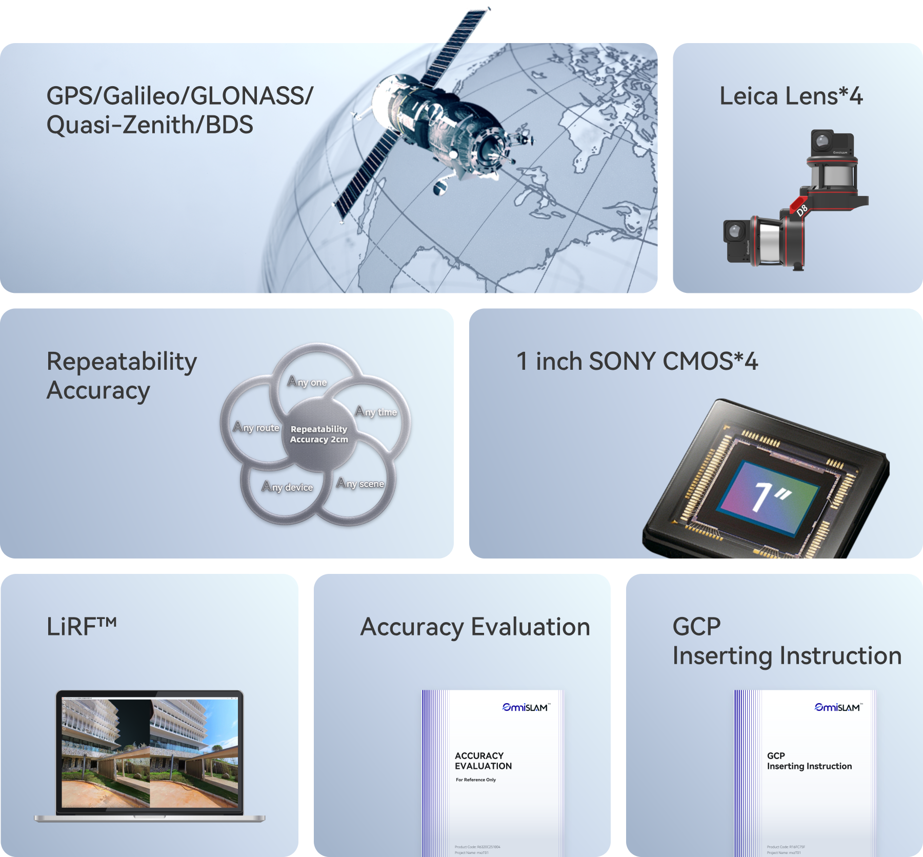
Accuracy (mm)
Guaranteed Technology
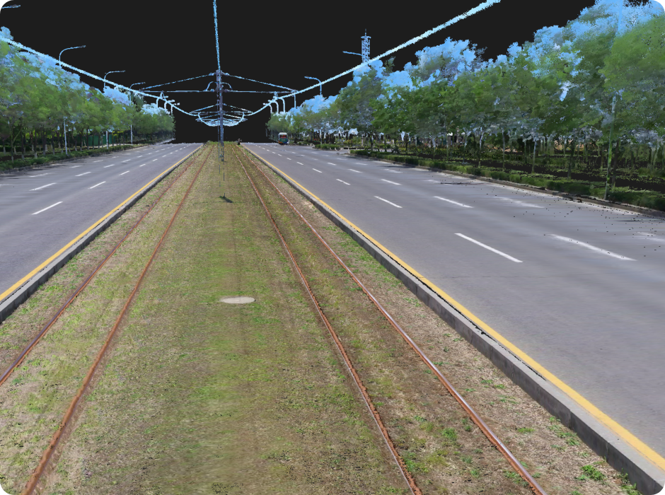
D8’s point clouds are vivid, closely aligned with real images, and accurate to the last millimeter.
D8 | World-Realistic Color, mm - Level Precision
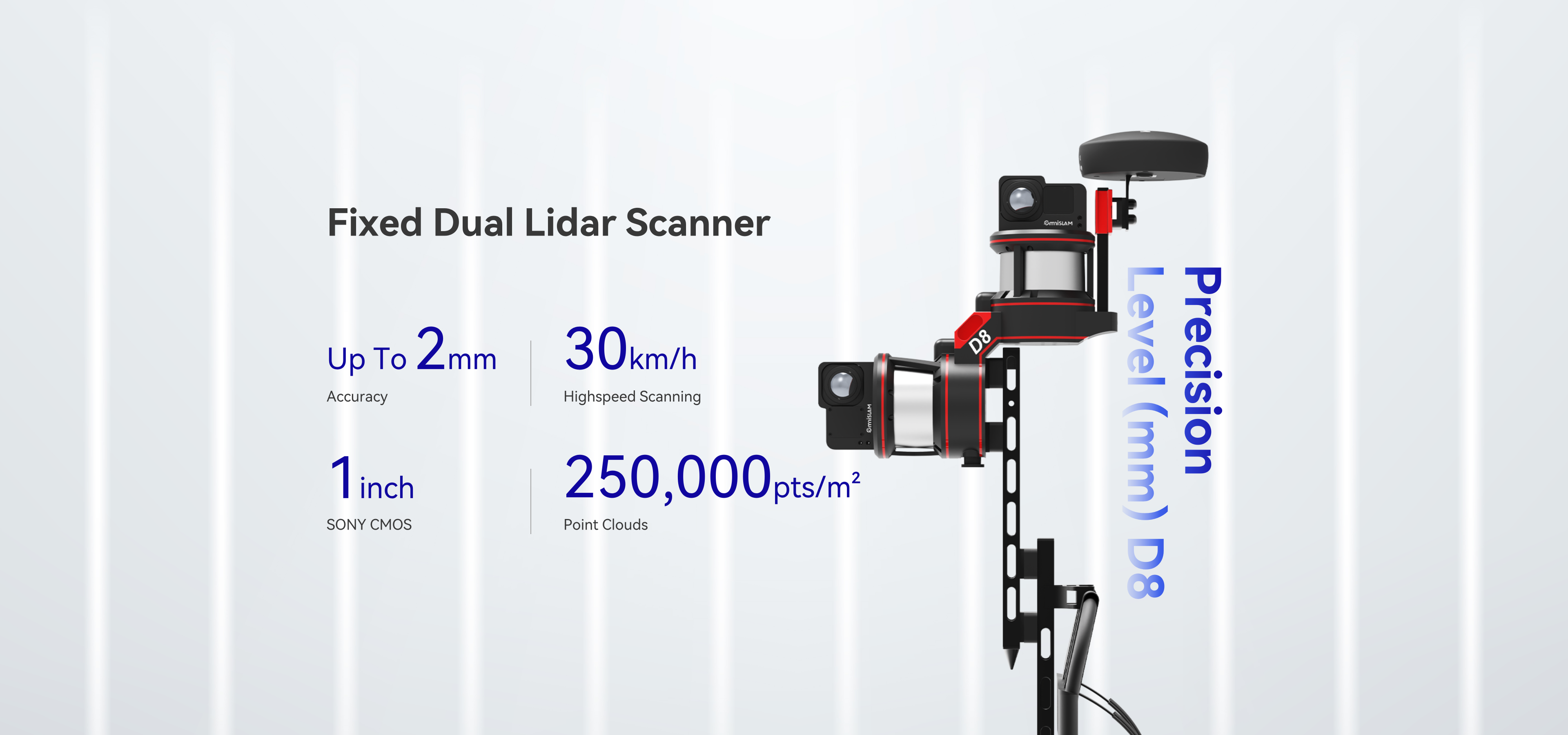
Accuracy (mm)
Guaranteed Technology
D8’s point clouds are vivid, closely aligned with real images, and accurate to the last millimeter.
30 km/h high-speed Scanning
D8 supports high-speed vehicle mounted scanning at 30 km/h, enabling you to acquire much more geospatial data in greater detail.
Efficient Workflow
at Every Step
The OmniSLAM D8 Mobile 3D Scanner removes the limits of TLS and greatly improves efficiency, making your work smooth and continuous.
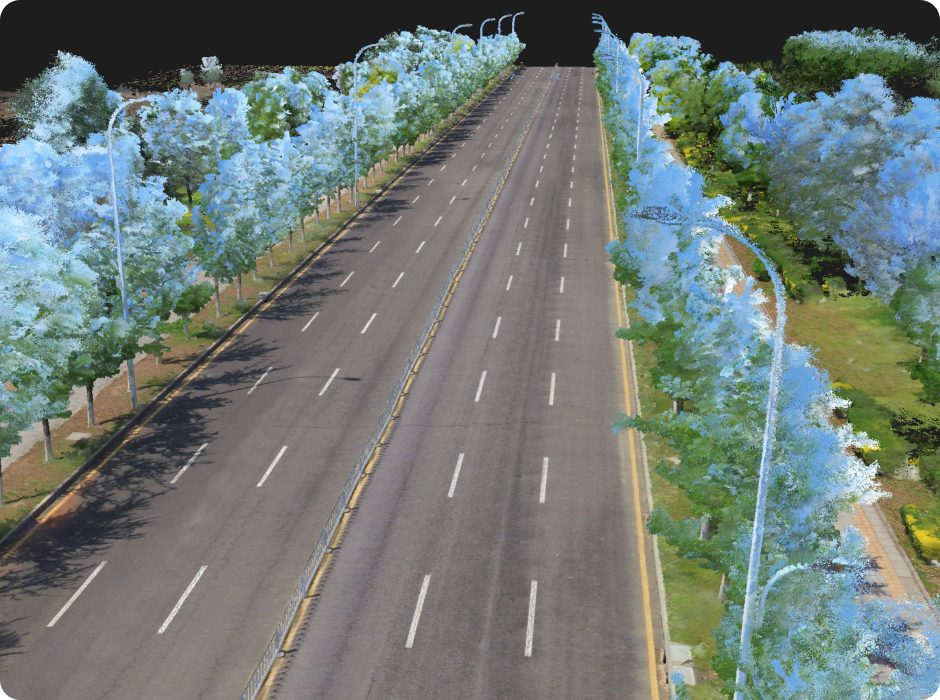
Fine-detail Capture
The OmniSLAM D8 captures details with impressive realism. Even small features that are often missed are clearly recorded, making the result look like a true replica of the real scene.

Large-scale
3D Gaussian Splatting
OmniSLAM 3DGS is purpose-built to address the digitalization challenges of ultra-large and highly complex environments. It enables unified, high-fidelity modeling of large-scale scenes such as industrial parks and major infrastructure. The system automatically generates ultra-realistic, high-clarity large-scene models, eliminating blur and distortion while delivering photo-level visual quality.
Dual screen linkage
between panoramic image
and color point clouds
D8 supports dual-screen viewing of panoramic images and color point clouds, so that users can view the same scene features simultaneously. Object judgment and drawing can be done accurately at the same time, which reduces cost and increases efficiency.