R8 | World-Realistic Color, Precision Level (cm)

Rotating Single Lidar Scanner

1 cm

Horizontal 1.8 cm
Vertical    2.5 cm

0.015°

1 cm

40,000 pt/m²

2 cm

Relative Accuracy

Absolute Accuracy

Leveling/Vertical Angular Accuracy

Point Cloud Thickness

Point Cloud Density

Repeatability Accuracy

R8
meets 5A-Criterion of
Surveying and Mapping

In the geospatial industry, Any scene is scanned by Anyone in Any route
with Any device at Any time, the UNIQUE point clouds should be
acquired theoretically.

Full Lifecycle
Auto-Calibration

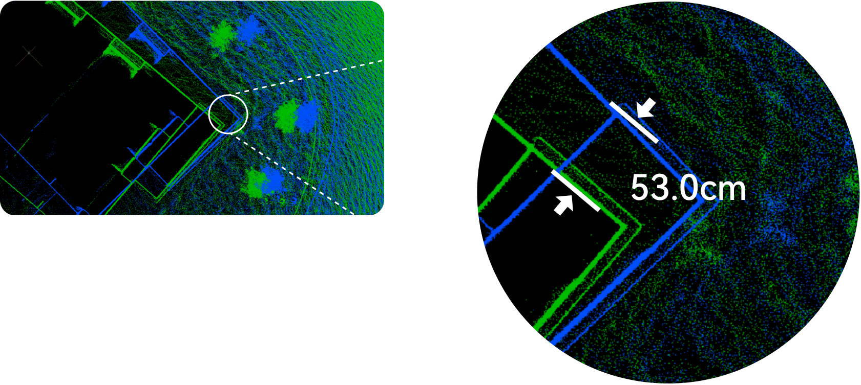
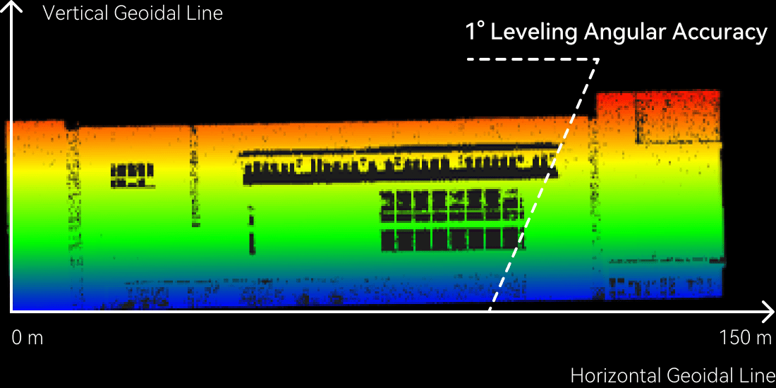
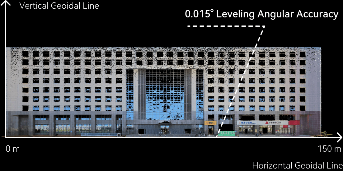
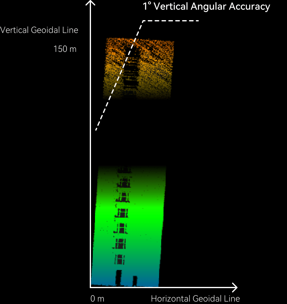
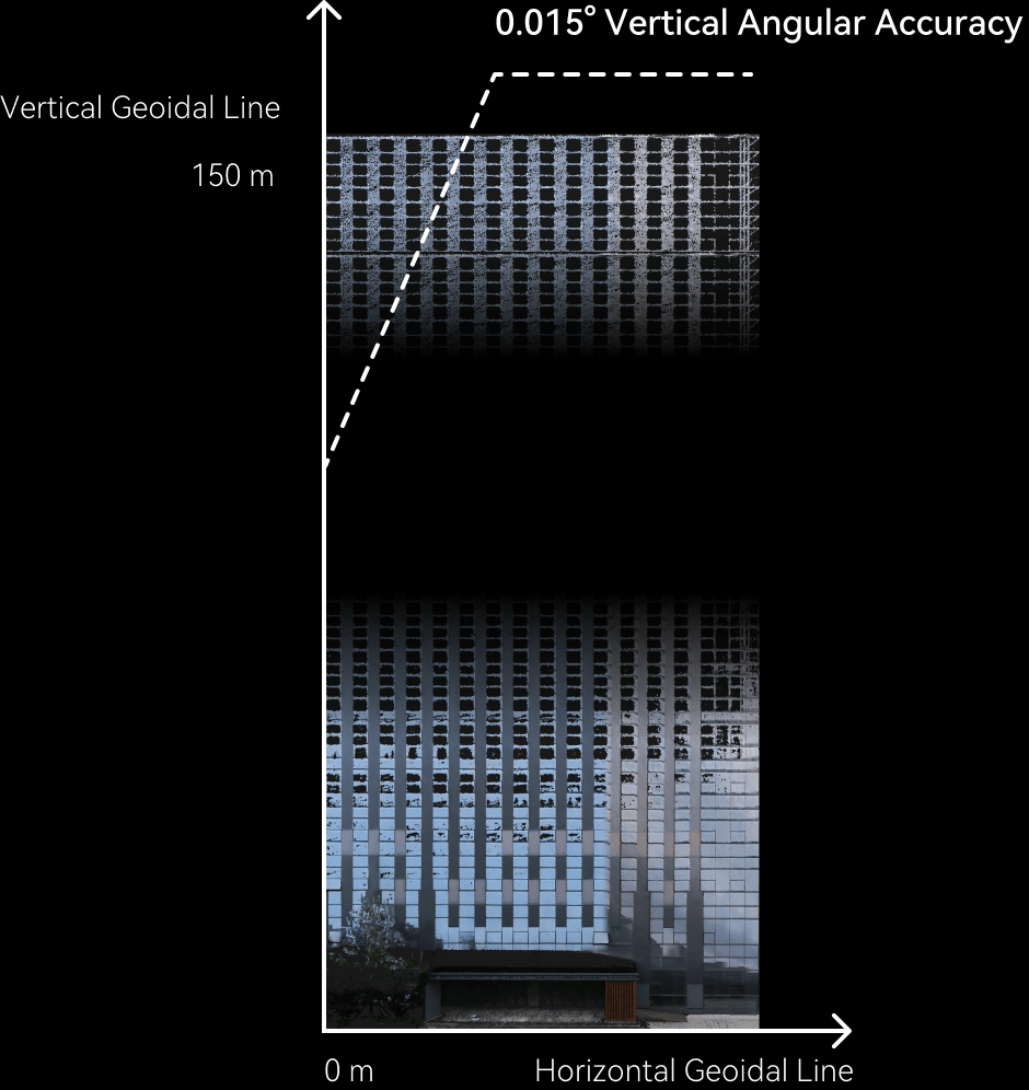
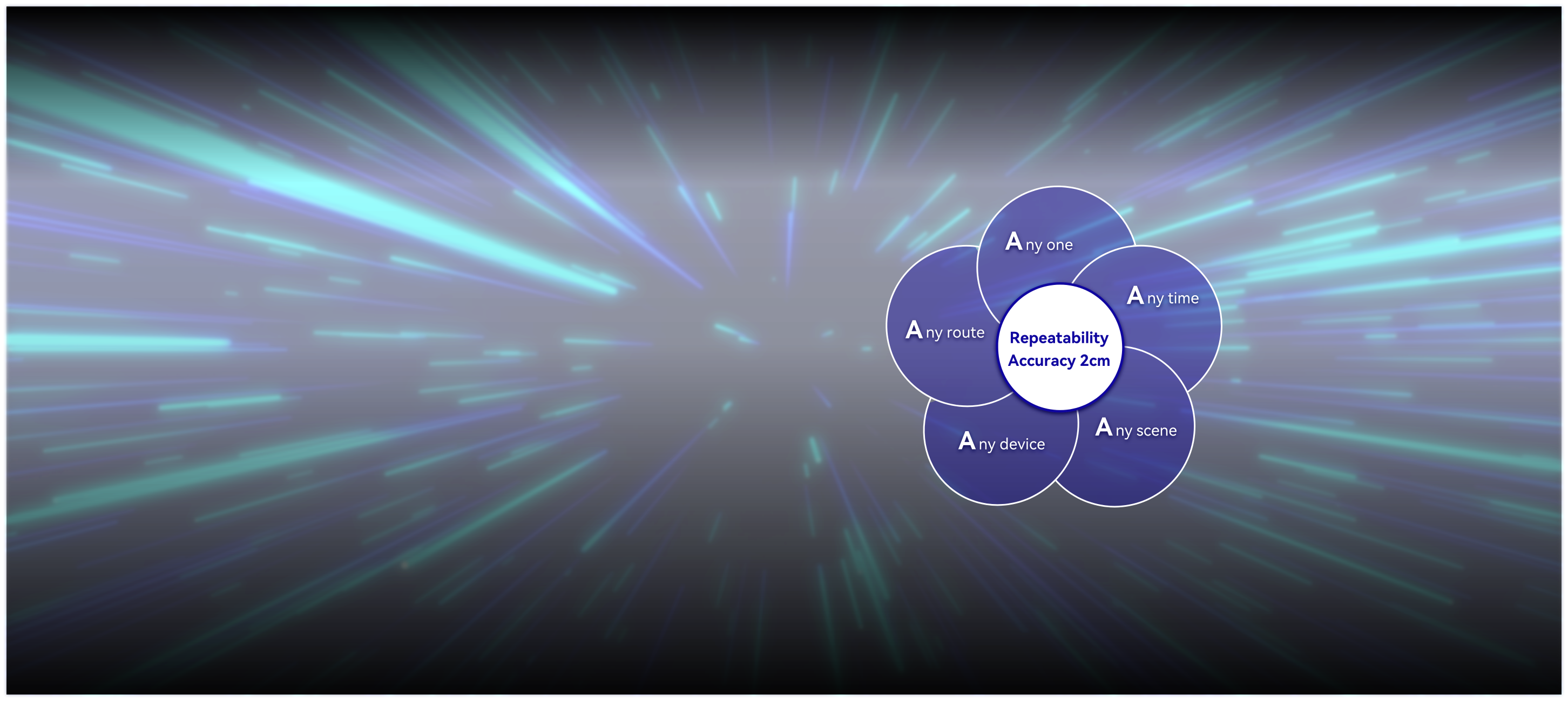
Self-Adaptive Online Calibration (SAOC) technology realizes full lifecycle auto-calibration of the scanner, which ensures that the point cloud thickness is always the same and the accuracy will never deteriorate from the day the scanner is in use, regardless of the frequency of use. There is no need to stop work and return to the factory for calibration.

Large-scale
3D Gaussian Splatting

OmniSLAM 3DGS is purpose-built to address the digitalization challenges of ultra-large and highly complex environments. It enables unified, high-fidelity modeling of large-scale scenes such as industrial parks and major infrastructure. The system automatically generates ultra-realistic, high-clarity large-scene models, eliminating blur and distortion while delivering photo-level visual quality.

Repeatability Accuracy

R8 meets the strict 5A criteria for surveying and mapping. The repeatability accuracy of the point clouds in WGS84 or local coordinates is within 2 cm by repeatedly scanning.

R8
Repeatability accuracy of two times scans

Point cloud coordinates of WGS84

Other scanners
Repeatability accuracy of two times scans

Point cloud coordinates of WGS84

*The two types of point clouds in blue and green are acquired by different operators using different devices to scan the same scene in different routes.

The dual screen linkage
between panoramic image
and color point clouds

R8 has dual screen function of panoramic image and color point clouds, so that users can view the same scene features simultaneously.

OmniSLAM PPK-SLAM
Tightly Coupled Complementary Filtering Algorithm

In the case of weak RTK signal quality, Misleading GNSS Fix may occur, which leads to the wrong point clouds. OmniSLAM PPK-SLAM, an innovative type of Tightly Coupled Complementary Filtering Algorithm independently developed by OmniSLAM, which is able to maintain accurate fixed solutions. Even in challenging environments, it can still acquire the WGS84 point clouds of 1:500 accuracy.

DLG(1:500) of Color Point Clouds

“Horizontal & Vertical”of
Point Clouds

The Mobile SLAM Color 3D Laser Scanner can generate absolute horizontal and vertical WGS84 point clouds. The leveling/vertical angular accuracy is within 0.015°.

Leveling angular accuracy of other scanners
Leveling angular accuracy of R8
Vertical accuracy of other scanners
Vertical accuracy of R8

Accuracy Evaluation

OmniSLAM Mapper generates an Accuracy Evaluation, which provides the Mean Value of Absolute Deviation(MVAD) of point clouds for each scan and the 3D thermal map of point cloud accuracy.

Accuracy Thermal Map of
Point Clouds

Multi-view “thermal map”, the different colors show the different accuracy, the position of accuracy point clouds is clear.

GCP Instruction

The Mobile SLAM Color 3D Laser Scanner of OmniSLAM generates a GCP Instruction. * For the point clouds of unsatisfied accuracy of a certain scan, the instruction will suggest the quantity and positon of GCP for generating efficiently.

“Detailed”
Carving of Point Clouds

R8 obtains the thickness of unfiltered point clouds is
1 cm with real edge and clear text.

R8 Other scanners 1 cm thickness of unfiltered point clouds 8cm thickness of unfiltered point clouds R8 Other scanners Clear Ambiguous R8 Other scanners Clear view of far from 50 m Ambiguous view of far from 50 m

R8

32

Laser Channels

120 m

Measure Range

640,000

Points per Second

Download

R8-300

32

Laser Channels

300 m

Measure Range

640,000

Points per Second

Purchase