RM+ | Mine-used Modeling (mm)

mm - Level Precision

2 mm
Relative Accuracy

The OmniSLAM RM+ captures high-precision colored point clouds for underground coal mines. It not only accurately reconstructs the geometric dimensions of roadways, but also delivers realistic color mapping to visually reveal critical safety features such as support conditions and water seepage traces.

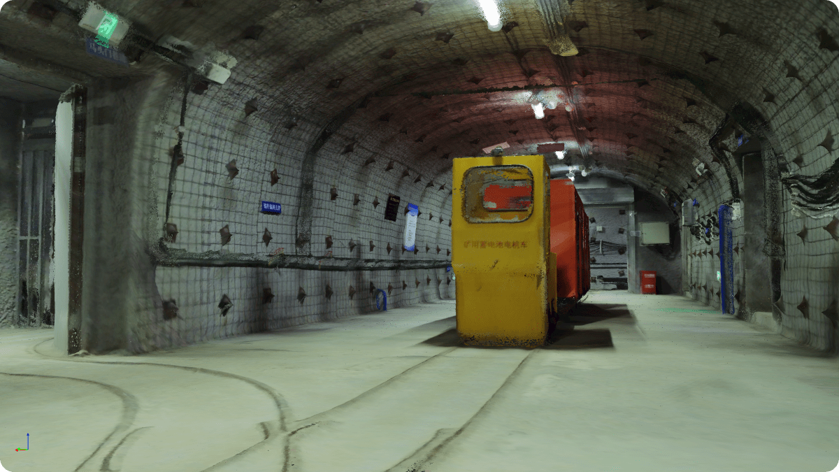
Next-Generation Standard

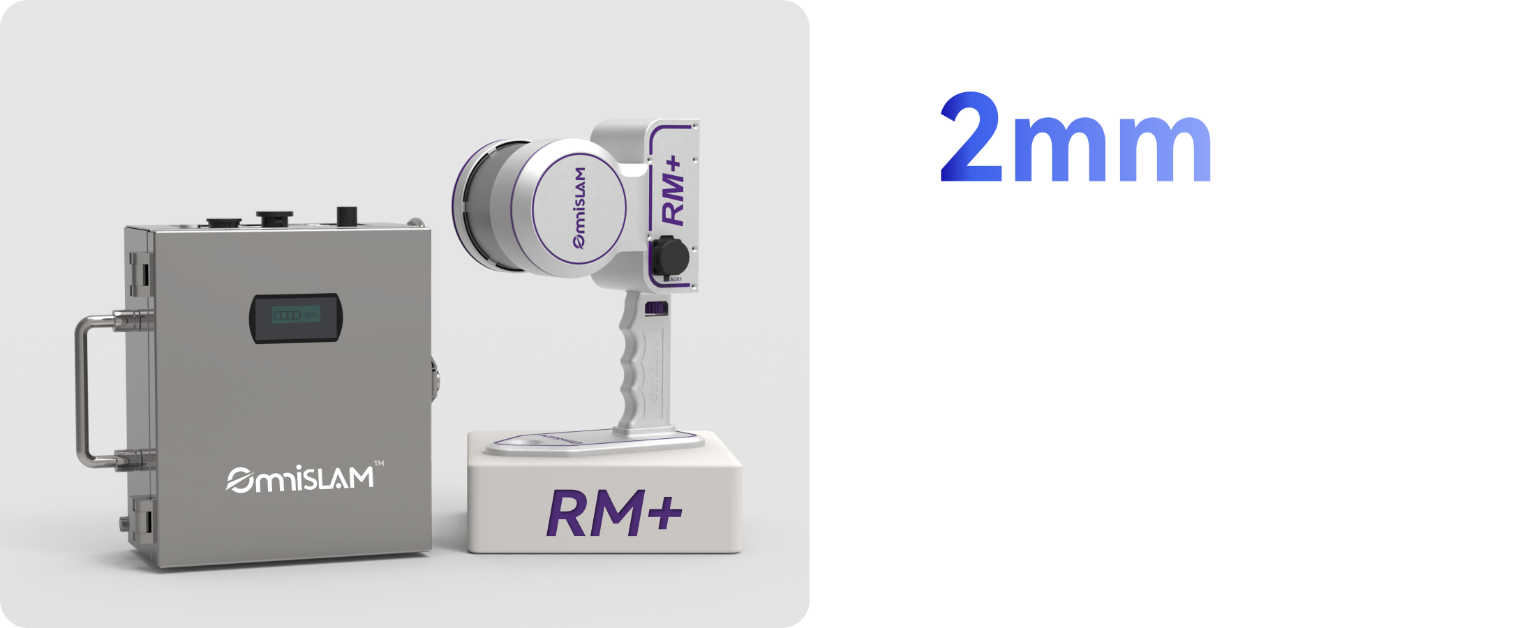
Compared with RM, the RM+ represents a new breakthrough in the quality of colorized point clouds for underground roadways. The generated colored point clouds offer higher texture resolution and more accurate colorization, delivering clearer, more refined visualization of roadway surfaces, equipment label identification and rock stratum structure recognition.

Mine Tunnel 3DGS Modeling

The automatically generated, high-quality 3DGS models faithfully preserve point cloud geometry and true-color textures, delivering real-time, high-fidelity 3D rendering of tunnels, equipment, and rock surfaces. Even in low-light underground conditions, they reveal fine visual details and natural light-shadow transitions.

Auto Mesh Modeling

The RM+ supports efficient mesh model generation on a single workstation, enabling rapid deployment for applications such as backfill analysis, simulation modeling and intelligent excavation projects.

Ultrathin & Accurate
Point Clouds

The ultrafine point clouds of the RM+ enhance post-processing analysis, enabling the acquisition of roadway section data and providing solutions for slope stability analysis and roadway development.

RM+ (mm) RM (cm) Point Cloud Thickness 2 mm Point Cloud Thickness 1 cm
RM+ Camera-Free Version

Available

Explosion-Proof RM+ is specifically designed for applications that prioritize millimeter-level geometric measurement over color imagery. Its overall point cloud quality exceeds that of the RM model.

RM+

32

Laser Channels

120m

Measure Range

640,000

Points per Second

RM+300

32

Laser Channels

300m

Measure Range

640,000

Points per Second