Boost the Construction and Maintenance of
Urban Transportation Infrastructure
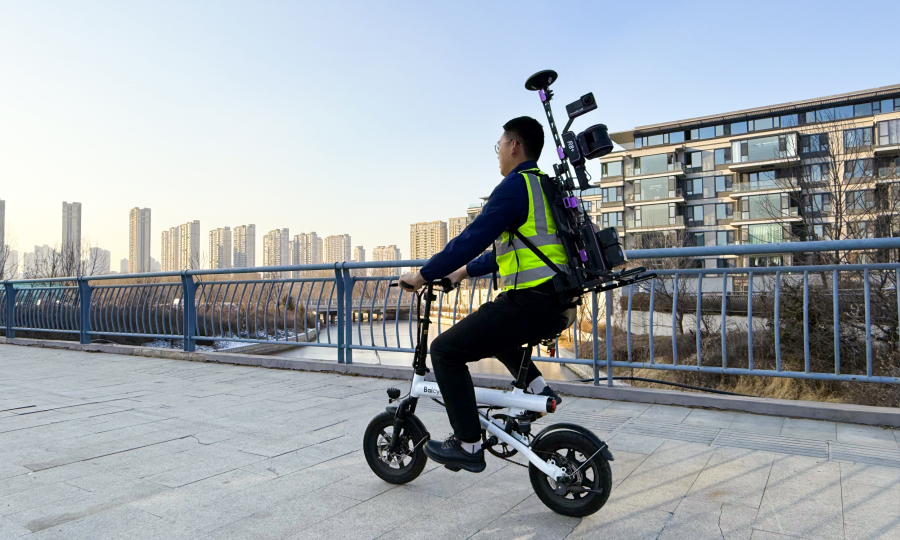
Scan with OmniSLAM “R8+”
Scanning
The "R8+" riding scanning can quickly complete the original data collection operation. Single uninterrupted scanning operation, unlimited time, and suitable operation mode greatly improve efficiency.
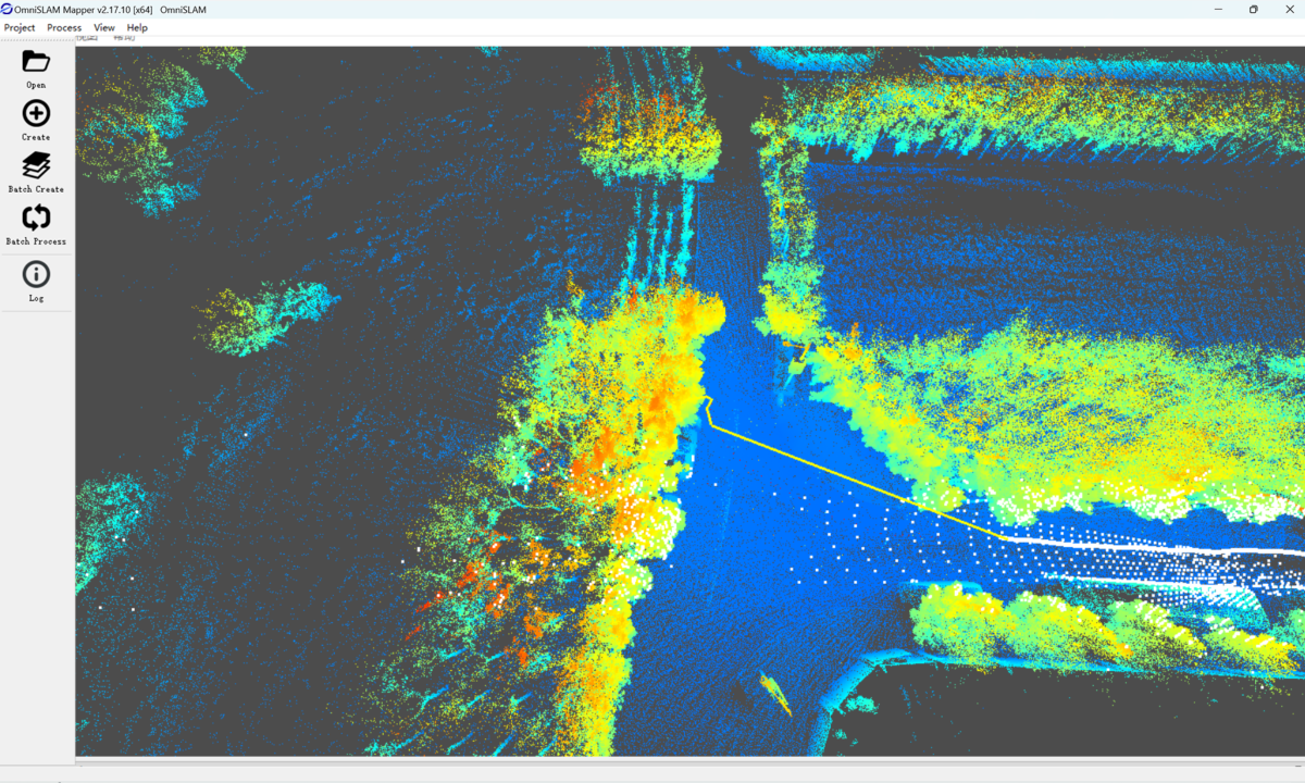
Processing
OmniSLAM Mapper, with auto process function and auto remove moving things fucntion, leads to the high precision point clouds.
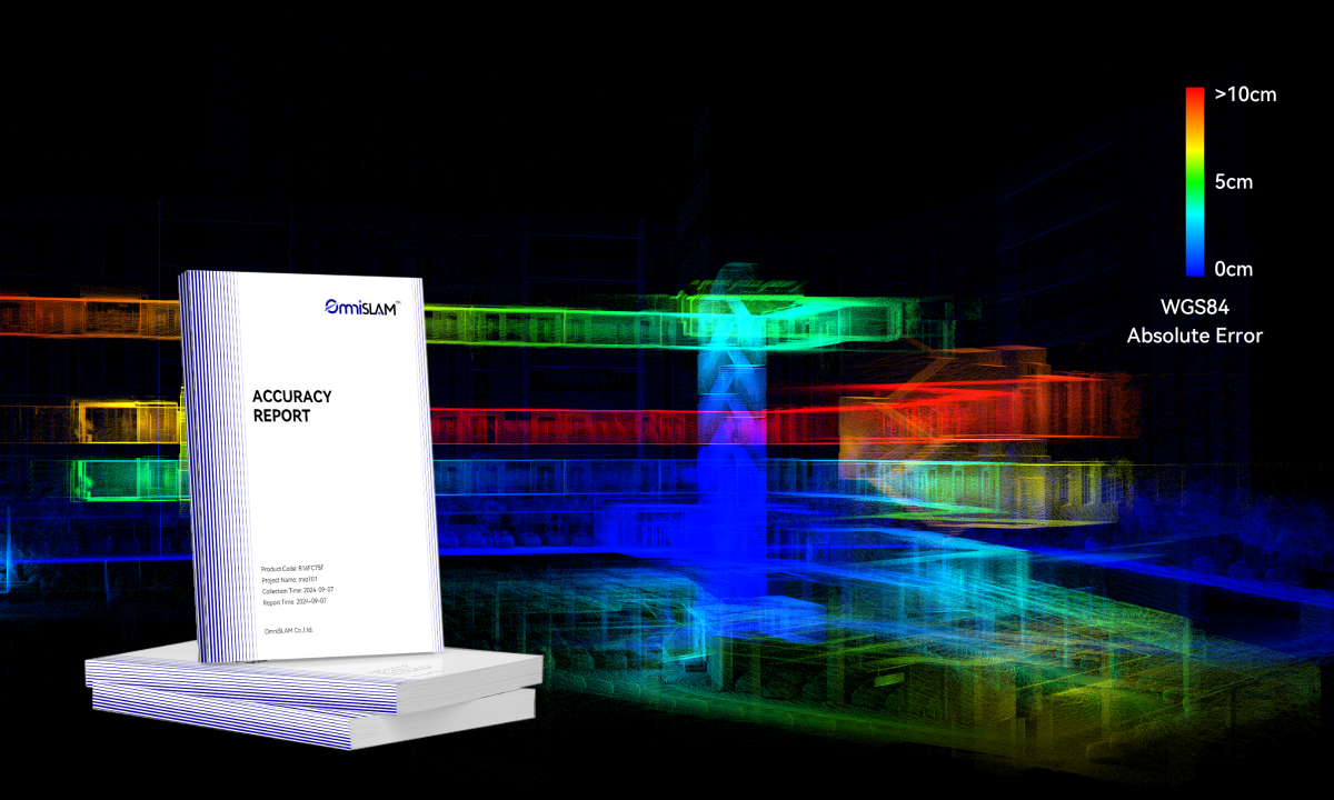
Verifying
According to the Accuracy Evaluation and GCP Instruction, to verify the point cloud accuracy.
Applying
OmniSLAM Works software generates the Project Data Results.


Solution Advantages
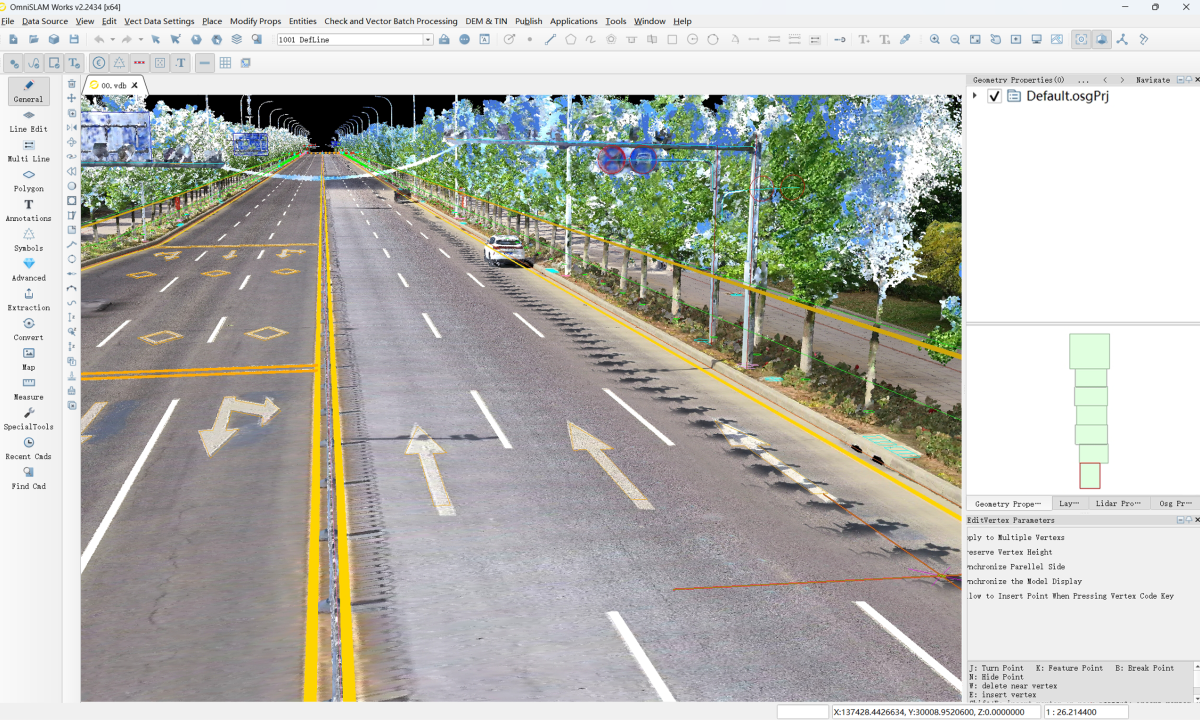
Refined and Dense
Color Point Cloud
The dense point cloud with 250,000 pts/m² assists engineers to quickly and accurately locate defects, providing a solid basis for subsequent repair and maintenance work.
Efficient Riding Scanning
A single ride can complete a 15 km/h task. The cycling scanning operation method is more suitable for project scenarios. It is lightweight, flexible, and low-cost. It ensures the quality and accuracy of the point cloud while improving work efficiency.

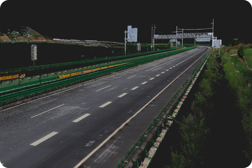
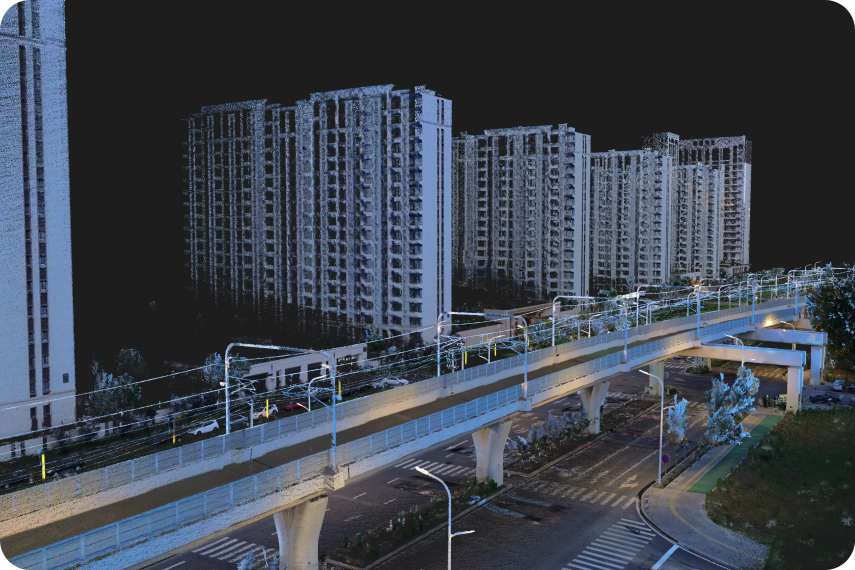
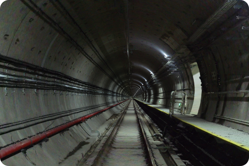
Absolute Horizontal and Vertical of Point Clouds
The long straight highway point clouds produced by "R8+" is absolutely horizontal, without deformation or stratification, and has precise coloring, which can provide reliable data support for urban infrastructure construction.
3 cm Absolute Accuracy in WGS84
The absolute coordinates of the aerial points and ground points in the point cloud reach an accuracy standard of 1:500, which fully meets the accuracy requirements of various projects and provides high-precision data support for engineering construction.